Lake Lanier · 6 min read
Before You Cut a Single Tree on Lake Lanier, Read This
On a Lake Lanier lot, your land usually stops at the government line, and the shoreline below it is federal land managed by the U.S. Army Corps of Engineers. Cutting trees there without the Corps' written permission is prohibited, and the Corps does not permit clearing for views or lawns. Find the line first, then clear your side.
Lake lot quote, on your side of the line. One business day.
The first walk down to the water
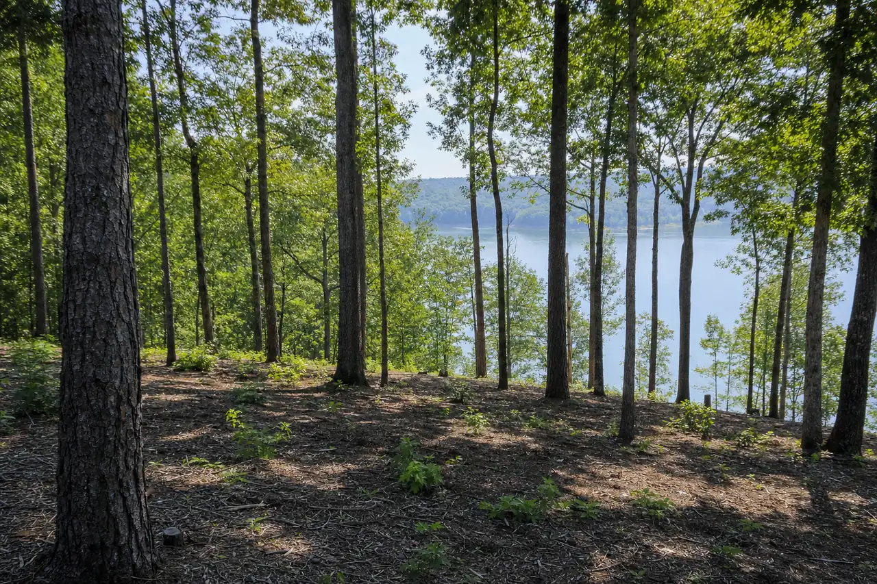
A typical lake lot call comes in spring from someone who bought on Lanier over the winter. They’ve walked down the slope from the deck, past oaks and pines and a thick layer of privet, briars and sweetgum saplings, to the dock. From the house, the water shows only in flashes through the brush. They want a view, and they want a price for taking out everything between the deck and the lake.
Our first answer is a question: where does your lot end? On most Lanier lots the deed stops short of the water, and the trees the owner most wants gone often stand on land the owner doesn’t own.
Your deed stops at the government line
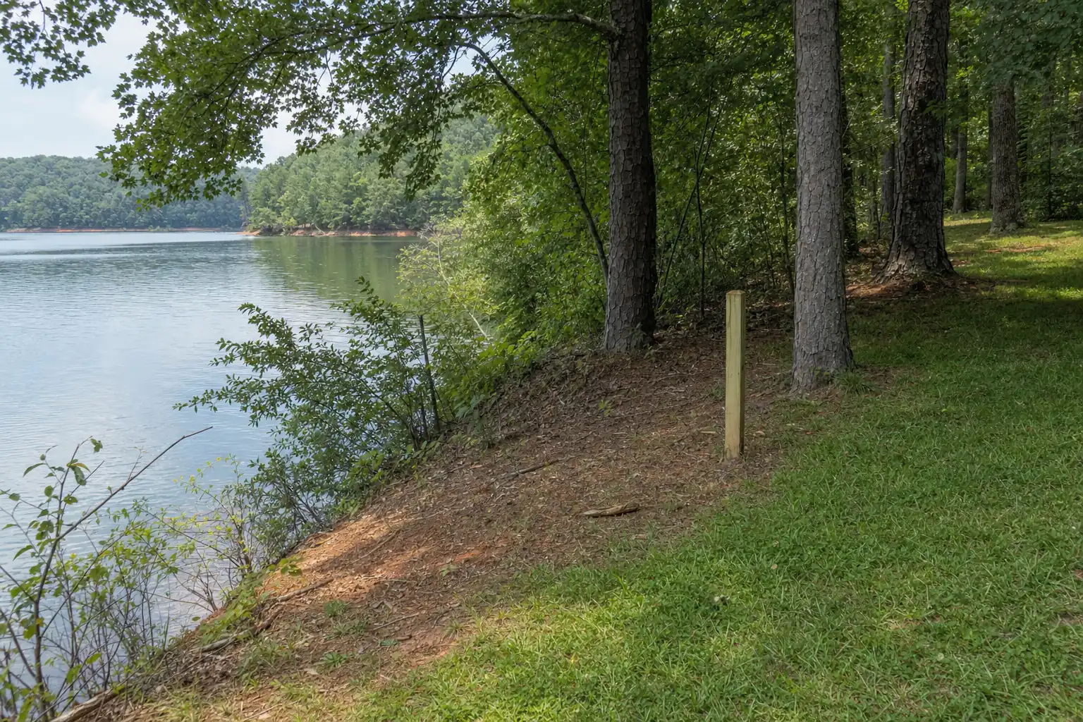
The U.S. Army Corps of Engineers manages the land around Lake Lanier. On a lake lot, your deed usually ends at the government line, wherever your survey puts it, and the strip from that line down to the water is federal property. The strip can be narrow or wide, and from the porch it often looks like part of the yard.
Shoreline rules are set by the U.S. Army Corps of Engineers under the 2004 Shoreline Management Plan and were checked on November 4, 2026. A revision is in progress. Confirm with the Lake Lanier Shoreline Management Help Desk before any work near the government line.
The water moves through the year. Summer full pool is 1,071 feet, and in a low-water season the shoreline drops away from the bank. The government line stays where the survey put it, so a dry summer doesn’t add any land you can work. Your plat shows the line, and corner pins mark it on the ground. If the pins are gone, a surveyor can reset them before anyone cuts.
What the Corps rules say
The rules are short. Federal regulation 36 CFR 327.14(b) prohibits cutting trees or removing wood from Corps project lands without written permission of the District Commander. The Corps’ fact sheet “Trees at Lake Sidney Lanier” adds the sentence lake lot owners ask about most: “Clearing to obtain scenic vistas or to establish lawns is not permitted.”
Lake Lanier and the Corps rules
- 692 mi
- Of shoreline at normal pool
- 30%
- Of the lake inside Forsyth County
- 1,071 ft
- Summer full pool elevation
- 2004
- Shoreline Management Plan that still governs the lake
Owners also ask about a vegetation modification permit for the strip in front of their lot. According to the rules we work from, vegetation modification appears on the Corps fee schedule under grandfathered permits only, and new authorizations are not permitted. A revision of the 2004 Shoreline Management Plan is in progress, so we recheck the rules each season, and the Corps’ Shoreline Management Help Desk has the current answer for your lot. The short version is in can I get a vegetation permit for my Lake Lanier lot.
The few things that happen below the line
The Corps allows a few narrow things on its land. None of them is clearing, and none of them puts a machine on the strip.
- A hazardous tree. If a dead tree on Corps land threatens your house, the request goes to the Corps, and the Corps decides. It can grant a Specified Act Permit for a one-time minor act such as cutting a hazardous tree. That permit carries no fee, runs 90 days, allows no equipment on government property, and usually leaves the wood where it falls. The Corps doesn’t remove low-risk trees.
- A path to the dock. Dock permit holders may maintain a 6-foot meandering path.
- Mowing. Only inside an authorized grass area under a Shoreline Use Permit.
We don’t work on Corps land under any permit. The longer guide is clearing near Lake Lanier: the Corps rules before you cut.
If the line gets crossed
The lot owner answers to the Corps for clearing past the government line, whoever ran the saw. A contractor who “opened up the view” packs up and leaves, and the violation stays with the lot. The consequences can include a federal citation and a fine, a required replanting plan for the cleared ground, and a voided dock permit. Cleared slope pitched toward a cove also starts moving red clay into the water with the first hard rain.
The usual stories start the same way. A previous owner kept a lawn down toward the water and the new owner took the lawn edge for the property edge. Or a crew underbrushing the slope reached the bottom with no line flagged and kept going. See what happens if you clear Corps land on Lake Lanier.
What you can clear on your side
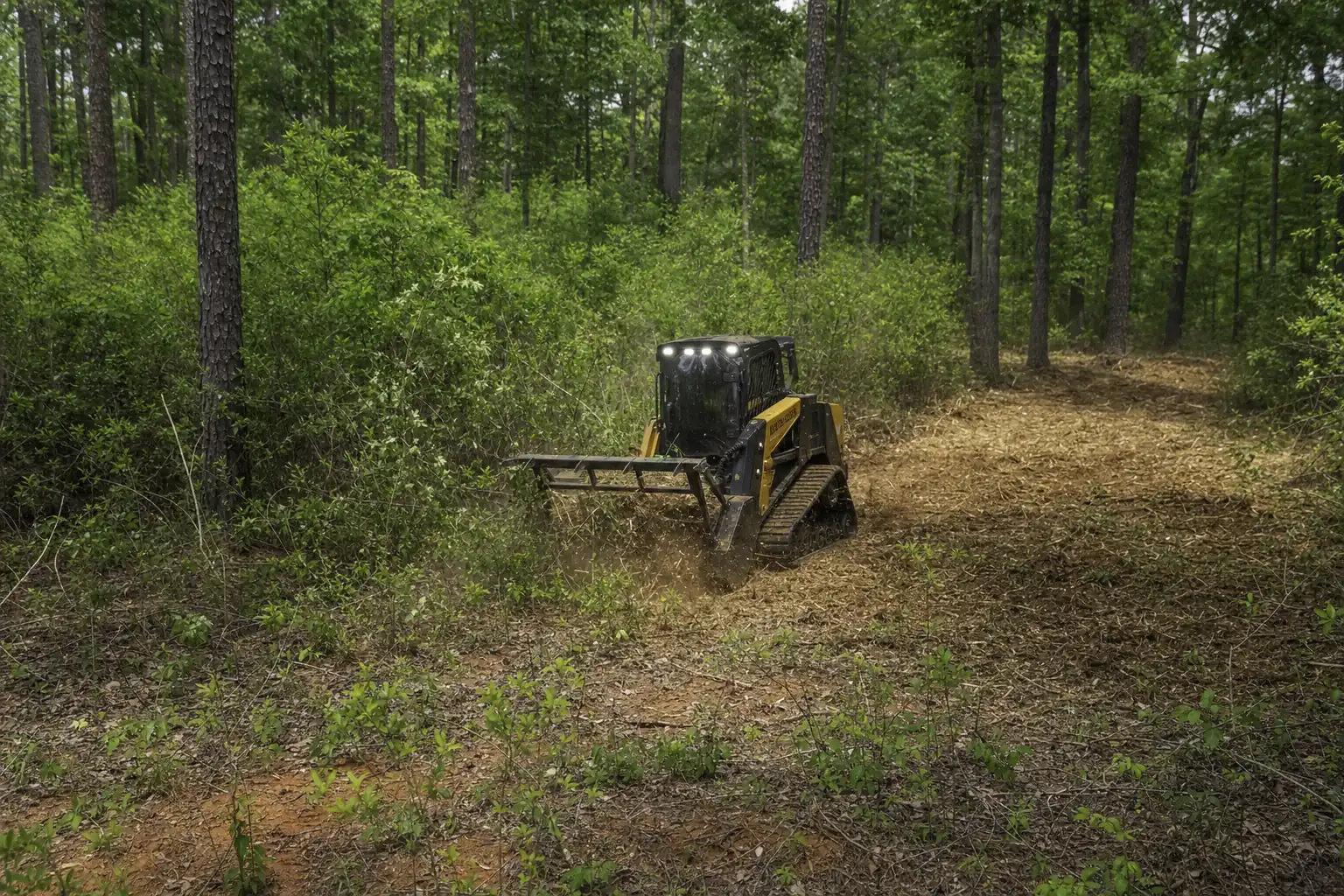
Your side of the line is where most of the brush problem sits anyway: privet, briars and sweetgum saplings filling in under the big trees on a slope toward the water. Mulching that understory opens sight lines through the trunks while the canopy stays up and the chips stay on the slope. Small trees on your property can be thinned for a filtered view, with the keepers flagged with you. See can you keep the big trees and clear the rest.
County rules still apply up the hill. A lake lot sits close to water, and Forsyth County’s land disturbance permit covers clearing within 200 feet of state waters even on jobs under an acre. We check the acreage and the distance on the walk, and silt fence goes in on the low side wherever the slope runs toward the lake.
Permit thresholds, fees and buffer widths are those published by Forsyth County and the State of Georgia as of November 4, 2026. Confirm current requirements with the issuing authority before work begins. This is not legal advice.
Leaf-off is the best time to judge a view. In winter you can see the water through the canopy, and the brush and saplings you’d take out stand apart from the trunks you’d keep. Privet and sweetgum come back from the roots within a season or two, so plan for maintenance mowing to hold the view you opened.
Lake Lot and View Clearing on Lake Lanier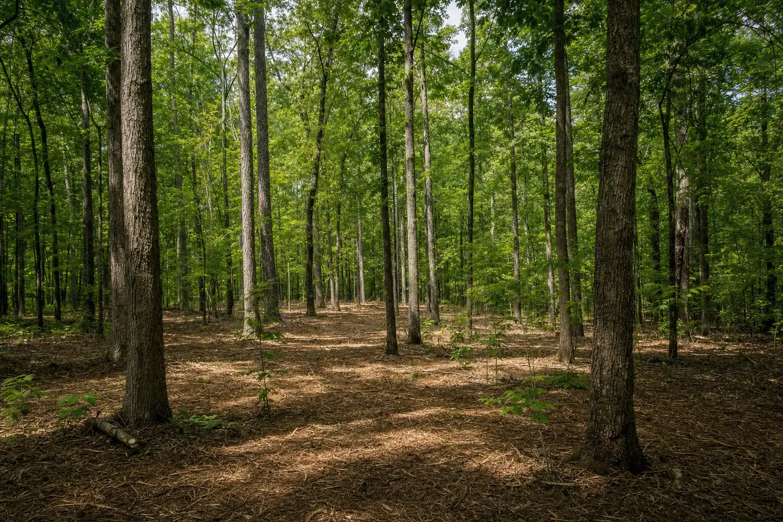 Underbrush Clearing: Open the Woods, Keep the Canopy
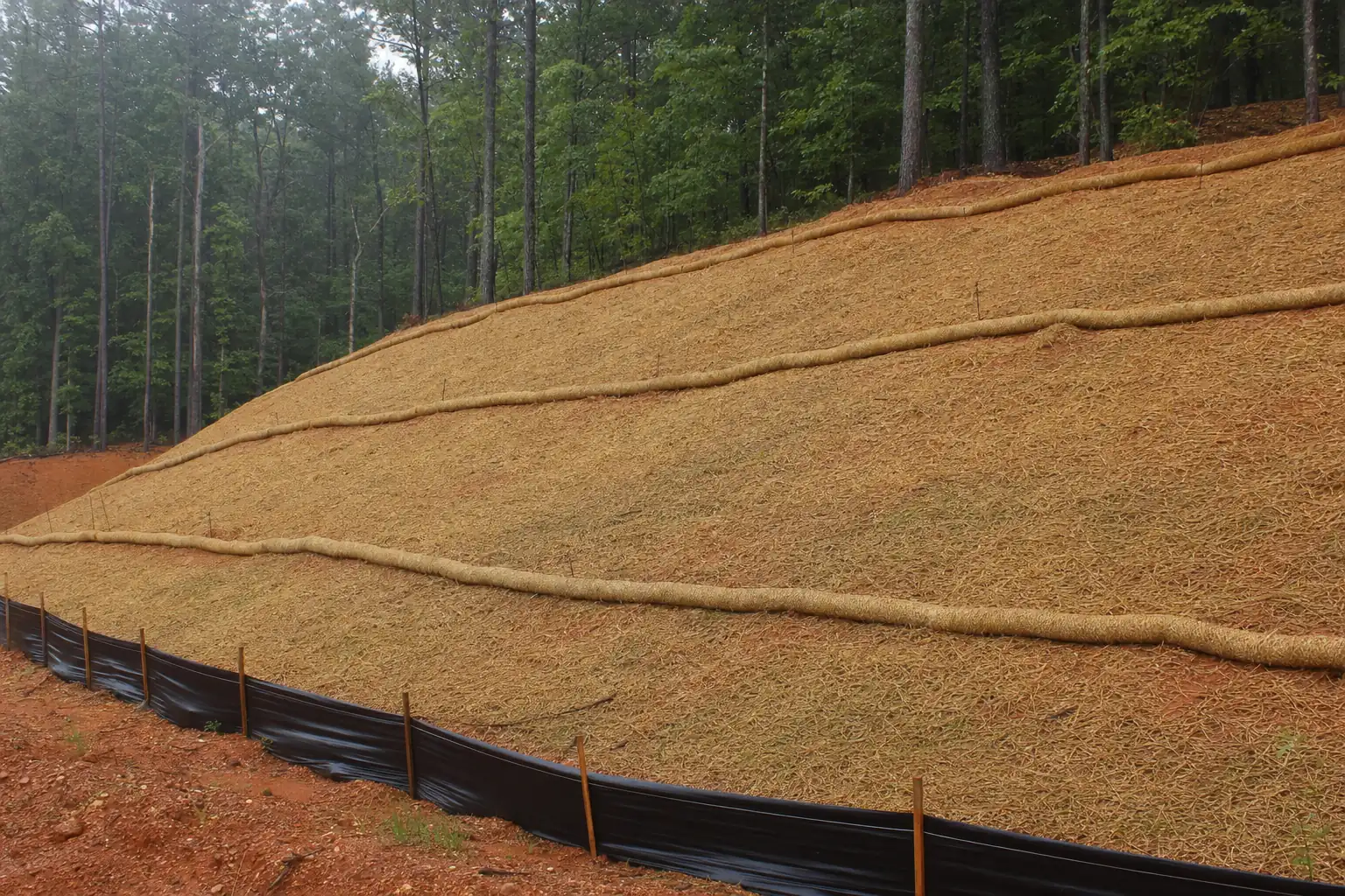 Erosion Control and Silt Fence Installation
Four checks before anyone cuts
- 1Find your platIt shows where your deed ends. A surveyor resets missing pins.
- 2Pull the Corps paperworkDock permit, Shoreline Use Permit, and any grandfathered vegetation permit.
- 3Ask the CorpsThe Shoreline Management Help Desk answers questions about the strip.
- 4Ask where the work stopsIf a contractor says at the water, find another contractor.
If you’re buying a lake lot, run those checks before closing. Ask the seller which Corps permits go with the lot and get copies. A listing photo taken from a mowed lawn below the line tells you nothing about what’s allowed there now. Look at what grows on your own side of the line, because that ground is where any view you open will come from.
The short version
Find the government line before anyone cuts anything. Below it, the Corps decides, and clearing for a view or a lawn is not permitted. Above it, underbrush and thin on your own land, keep the slope covered, and expect the county’s permit rules near the water. Our lake lot and view clearing works that way. The yes-or-no answer is in can I clear my lot down to the water, and the county’s side of the rules is on the erosion control and permits page.